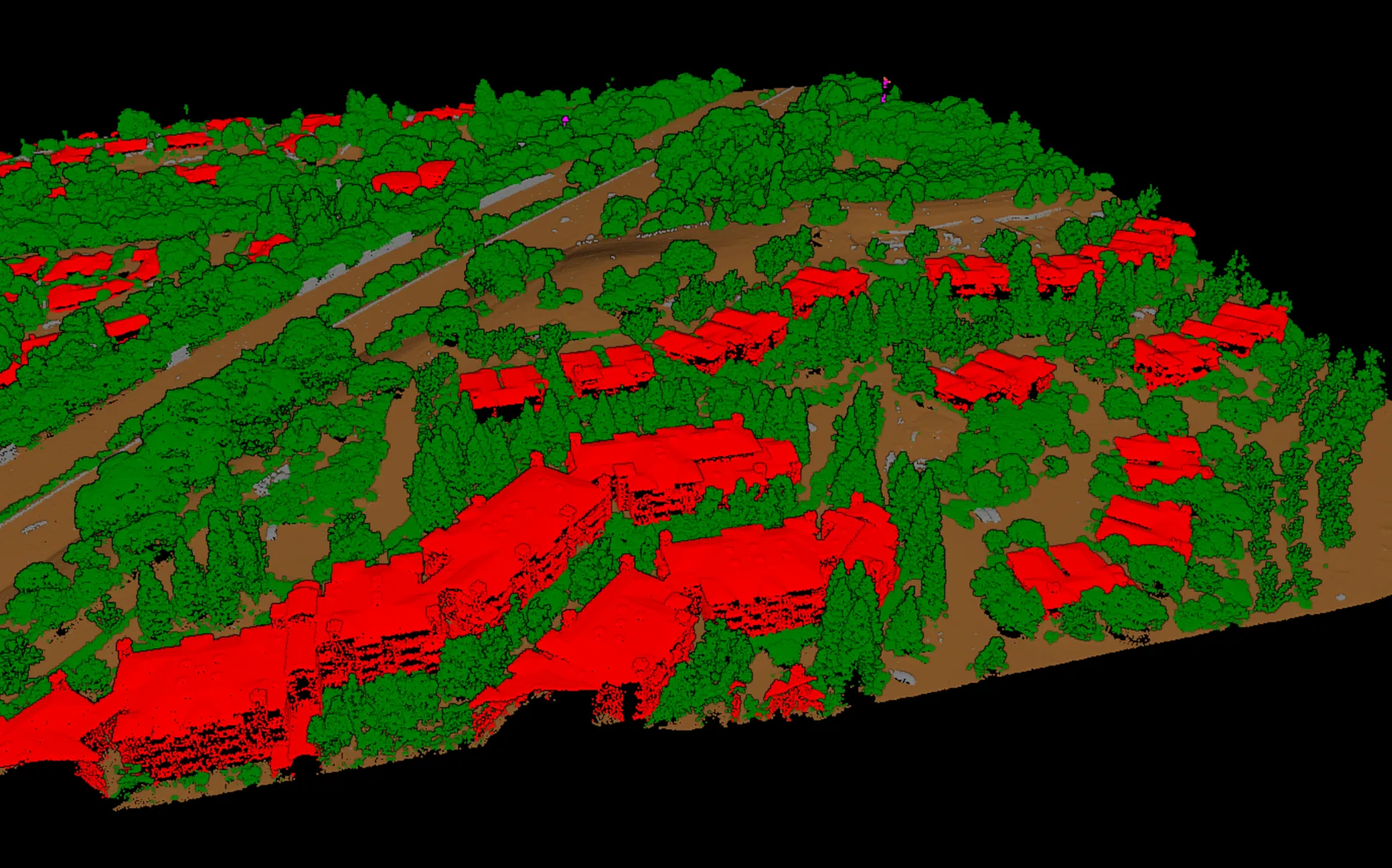
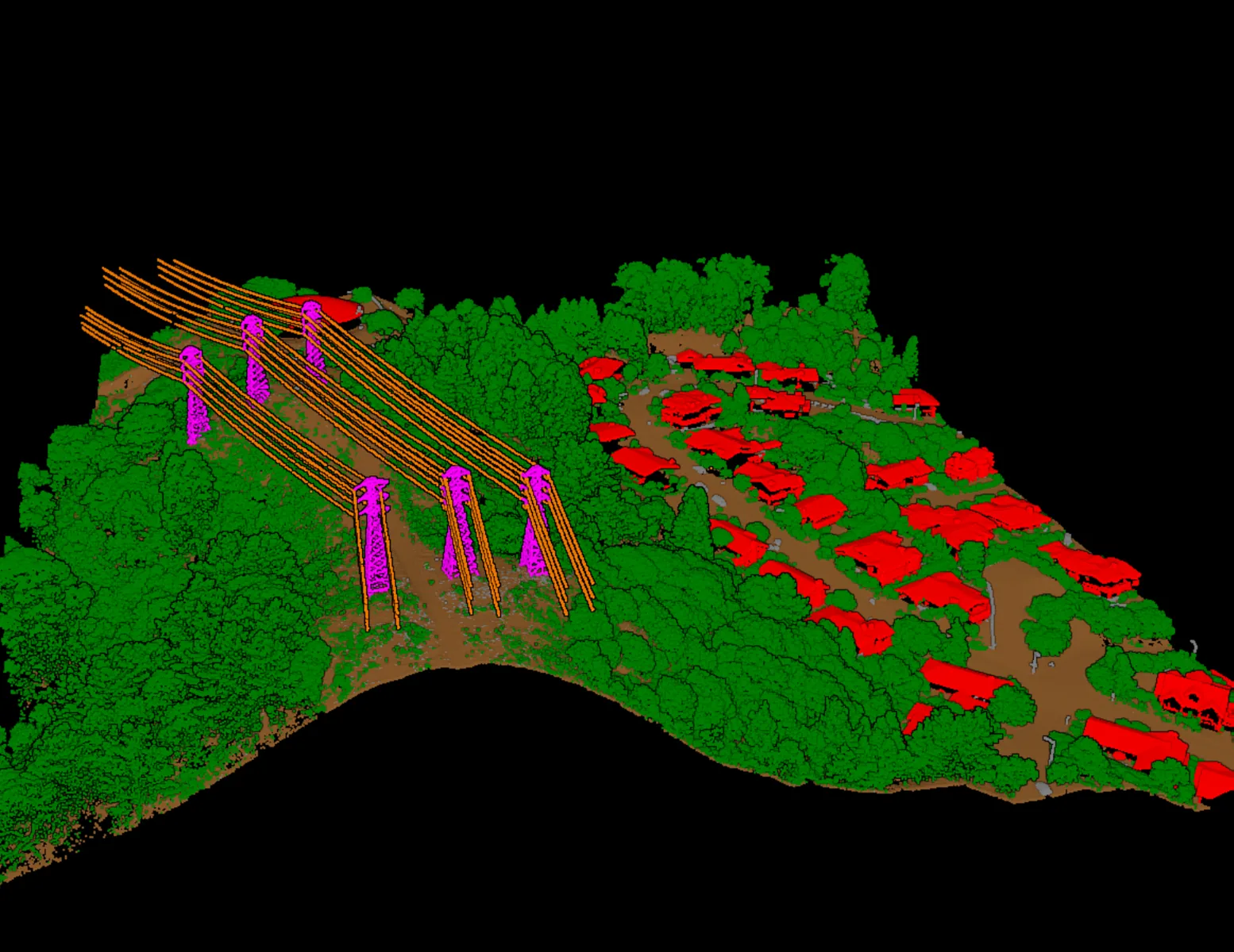
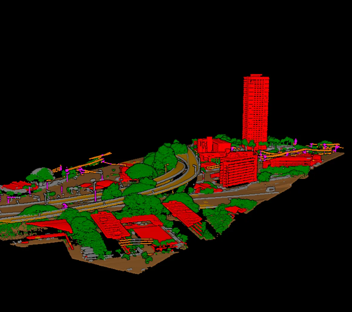
Industries

Industry focused LiDAR classification, run locally.

Vecten Desktop classifies large point cloud blocks for mapping, utility corridors, infrastructure, terrain, and public-sector geospatial programs without sending data to a cloud workflow.

Industry use cases

Start with the work your team delivers.

The industry context determines the required classes. VClassify handles general semantic classes, VGround focuses on terrain, and VUtilities adds corridor assets.

VClassifyVGround

Survey and Mapping

Classify large LiDAR blocks into the public classes mapping teams need before production review: ground, vegetation, buildings, water, and related scene features.

Production work

Topographic mapping, municipal base maps, survey production blocks.

VUtilities

Utilities and power corridors

Separate conductors, poles, and transmission towers in corridor blocks so utility teams can review asset classification before analysis or delivery.

Production work

Transmission corridors, right-of-way LiDAR, utility asset classification.

VClassify

Transportation infrastructure

Prepare classified ground, building, water, and bridge-deck outputs where infrastructure blocks must be checked before engineering handoff.

Production work

Road corridors, bridge approaches, civil mapping blocks.

VGround

Engineering terrain

Produce ground-focused classifications for surface review before terrain deliverables move into existing civil or GIS tools.

Production work

Ground extraction, terrain review, engineering survey blocks.

Evaluate Vecten Desktop on one production block.

Send the industry context, required output classes, and local-processing constraints. We will confirm the module fit before the evaluation.

Request Early Access